
|
|
- Map of Carbon County
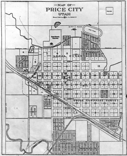
- Price City in 1920 - scanned from The New West Magazine, Feb. 1920 vol XI No. 2
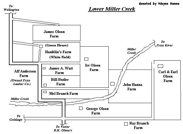
- Map of the farms in Lower Miller Creek
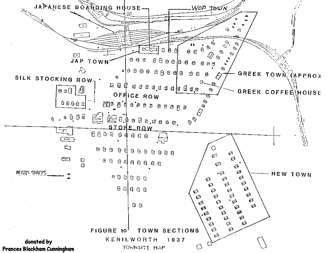
- Town of Kenilworth in 1937
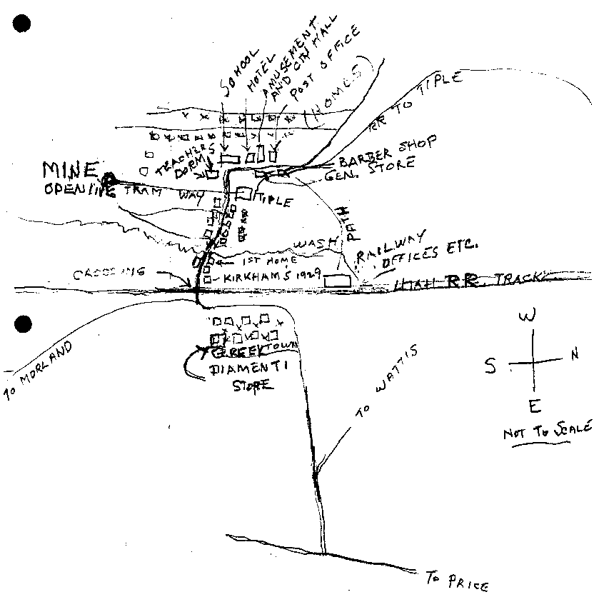
- Map of Hiawatha - drawn by Jack Kirkham
- Columbia 1930's-early to 1940's - Michael Francis has used the Sanborn map of 1929 of Columbia and with the help of his friends and family, George Mavrakis, Thelma Kasselas Mavrakis, Ivan McCourt, George Tratos, George Koukoutsakis, Kula Mavrakis Francis and Abe Garcia, labeled the homes with the names of the individuals who lived in each house. If you are interested in obtaining a copy of this map you can e-mail Michael Francis or Kathy Hamaker. There will be a charge for the copy since the map is approximately 30"x 36".
- Sanborn Fire Insurance Maps - Maps are on the University of Utah library, J. Willard Marriott Library Digital Technologies webpage. Maps of Columbia, Helper and Price are available.
- Utah.maps.com - has HUGE map files to download of maps, images, and ArcInfo GIS coverages. Maps of Carbon County locations are available.
- Genesee & Wyoming, Inc. - contains map of the Utah Railway Routes
- Map Geeks - State & County Maps of Utah
- Internet Archive - contains maps of the Utah Terminal Railway at Peerless, Spring Canyon Branch, and Storrs.
CARBON CO., UTAH UTGenWeb
Maps
How to read old maps of Price
News Advocate 2 Feb 1926
New City Numbering System in Effect, Streets of Price Known by New Names
Do you call the street leading up from the station, Eighth street, the street by the tabernacle, Seventh street, and so on?
Then, taking it for granted you do, right now is a good time to forget these old appelations and begin referring to the two thoroughfare names as "Carbon Avenue" and "First East Street".
Plats of the entire city, including all subdivisions, with every street renamed and every house or building spotted thereon, according to the ordinance passed recently by the city council, were completed this week. New numbers will be placed upon the houses within the next few days, and for the first time in its history, Price will have an ..... comprehensive system of street and house numbering.
Under the new system, the center of the city is fixed at Main and Carbon, or what was formerly Main and Eighth streets. Beginning at this intersection, streets are counted in numerical order north and south of Main street and east and west of Carbon avenue. Thus, First East street is one block east of Carbon avenue, both north and south, of Main and First South street is the first street south of Main, both east and west of Carbon. The same rule applied to all streets radiating from the center point. Numbers of houses are determined on the basis of allowing 100 numbers to each block. The new system being put into effect is acknowledged as being about the most simple and understandable in use today, and is the system used in many of the larger, up to date cities.
Maps on other servers
[ Photographs ] [ Surname Page ] [ Query page ] [ Links ] [ E-mail ]